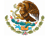
 Mexico exists in large part due to the Aztec civilization, and the Mexican state of Nayarit is Aztec country. Even the great Maya of the Yucatan Peninsula were invaded by Aztec predecessors. Long before the “Riviera Nayarit” was considered a tourist destination, it was part of the influential Aztec empire. Credited for naming the country of Mexico, the Aztecs also authored the crest in the center of the Mexican flag, which became the Mexican National Emblem.
The image of the emblem comes from the Aztec legend, which identifies their new settlement as the place where a heron would be seen sitting on top of a cactus in the center of a lake capturing a snake in its beak. On their pilgrimage from the island of Mexcaltitán in 1091 – considered the mythical Aztlán and birthplace of the Mexican identity – they searched for this new land, witnessing the snake-capturing heron in the region now known as Mexico City, and built Tenochtitlán in 1325, a significant site of ancient Aztec ruins today.
 Arising out of this legend, historians believe the mythical name of the island, “Aztlán,” means “land of the herons” in the Aztec Nahuatl language, and its formal name “Mexcaltitán” derived from the Nahuatl “Metztli,” their moon goddess, which means “in the moon’s house.” While the island may have multiple names, they do know the Aztecs eventually referred to themselves as the Mexicas after settling in the new region and calling it “Mexica,” which stems from the island name and later evolved into “Mexico.”
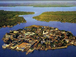
Mexcaltitán’s historical significance makes it a truly magical place today. After receiving Historical Monument status in 1986, the island was designated by the Mexican government as a Pueblo Magico (magic town). The Pueblos Magicos (magic towns) program began in 2001 to support the preservation of valuable historical areas which influenced Mexican culture and tradition. With about 40 Pueblos Magicos, it has increased tourism and income to towns that model Mexican culture, history, and architecture.
 Built in pre-Columbian Mesoamerica by the Aztecs, this small island is only 400 meters (1,300 feet) in diameter, has no cars, and can be easily traversed by foot within an hour or two. The island is accessible only by boat and is a 20-minute ride from La Batanga pier on the mainland near San Blas. During rainy season, September through November, the roads are normally under water, making the only way around town by boat and earning it the nickname: “The Mexican Venice” (La Venecia Mexicana).
Surrounded by wetlands and endangered mangroves, conditions are ideal for shrimp fishing, the primary livelihood of island residents. Mangrove marshes are natural shrimp habitats and also provide material to construct levees and make barcinas (special bags) for drying shrimp, the latter consisting of manta cloth and palm leaves. Travelers who enjoy eating shrimp will find a variety of regional specialties with fresh shrimp, such as zarandeado, tamales, paté, and aguachiles (spicy lime shrimp). It is also the place where dried, crunchy shrimp or “cockroach shrimp” were created, a delicious snack served with chilled cerveza (beer).
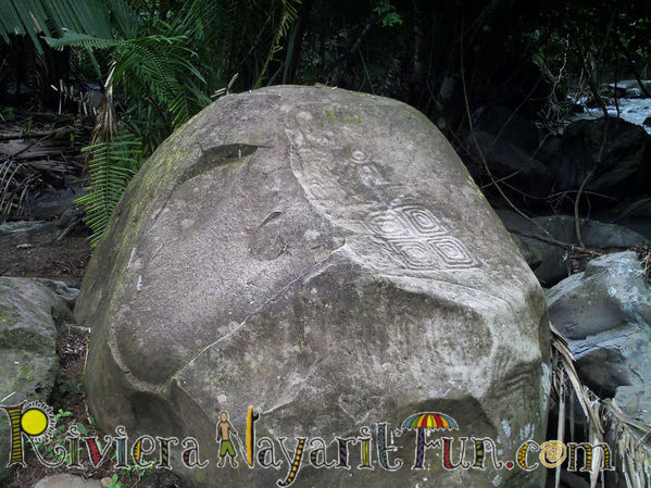
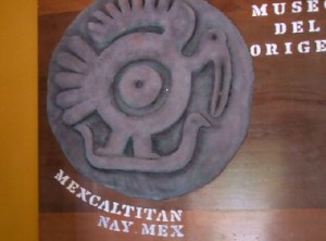 For such a small island, its rich history offers significant cultural attractions. Dotting the natural landscape of this picturesque little island are traditional tile-roofed buildings and small unnamed stores that residents identify by memory. Central to the island is the town square with a church and museum, Museo del Origen (Museum of Origin) which contains artifacts of Mesoamerican history and Aztec culture, including an archaeological stone engraving with that meaningful image of the heron capturing a snake, without which, Mexico may not be known as the cultural treasure it is today.


